Environmental Factors in Perth County Commercial Land Appraisals
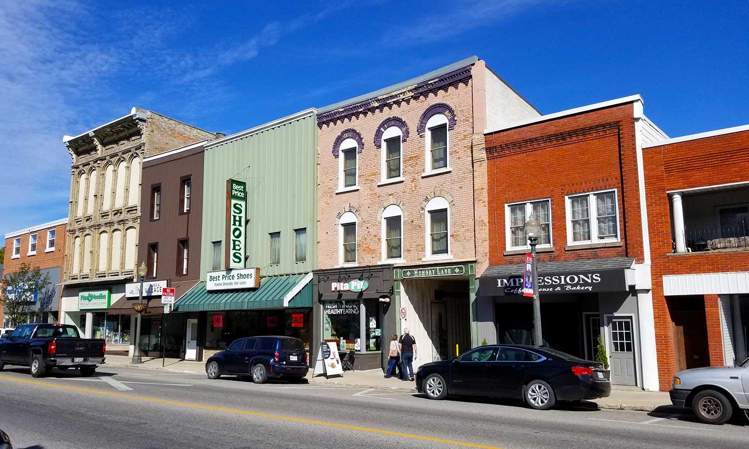
Perth County’s market looks straightforward on a map, a lattice of towns and farm blocks between Stratford, St. Marys, Listowel, and Milverton. On the ground, the environmental story behind a piece of commercial land is more layered. Appraisers who work this corridor know that value hinges not just on frontage and zoning, but on soils, flood risk, old land uses, and how regulators view the site. When I review a commercial property assessment in Perth County, I find myself asking a pattern of questions that come from years of files where a subtle environmental constraint reshaped the highest and best use.
The environmental profile of a site is not just an academic note in the report. Lenders tighten terms, insurers ask hard questions, and developers recut pro formas when they see environmental flags. Deals that look rich on paper lose their edge once you price the cost to cure. That is true in Kitchener and Toronto, and it is true in Shakespeare and Atwood, just with different actors and constraints.
Where land meets water, clay, and regulation
Perth County sits within several conservation authorities, including Upper Thames River, Maitland Valley, and Ausable Bayfield. Each carries its own floodplain mapping, regulated area layers, and permitting regimes for site alteration. Add to that source water protection zones under Ontario’s Clean Water Act, and you begin to understand why a simple corner lot can surprise buyers. A property inside a wellhead protection area has extra conditions for certain commercial uses that store chemicals or fuel. In a few cases, proposed uses are effectively unworkable without mitigation.
Soils and drainage define the cost of site works. Much of the county rests on till plains with clay and clay loam. For commercial pads and parking fields, that can translate to underdrainage, thicker granular sections, and careful stormwater design. If you come from a sand base market, adjust your expectations. Geotechnical investigations in this area routinely find perched water tables, which in turn influence the feasibility of basements, foundation type, and the likelihood that vapour barriers will be needed if volatile contaminants are present.
Site alteration intersects with Ontario’s Excess Soil Regulation, O. Reg. 406/19. If you plan to excavate for foundations or install a stormwater pond, the movement and reuse of soils must satisfy the new quality and tracking rules. Buyers who ignore this find out the hard way that export and disposal can add six figures to a mid-size commercial project.
How environmental due diligence shapes valuation
Commercial building appraisal in Perth County follows the same three approaches as anywhere else, but environmental factors touch all of them. Under the cost approach, the cost to cure contamination, to mitigate flood exposure, or to upgrade stormwater management depresses contributory land value, often more than the building itself. For the sales comparison approach, you cannot use a clean highway convenience store sale to price a former service station two blocks away without a serious adjustment for stigma and cleanup risk. On the income side, tenants such as food retailers and medical users tend to avoid certain risks, which narrows the tenant pool and changes downtime and allowances.
Commercial building appraisers in Perth County are cautious with extraordinary assumptions. A Phase I Environmental Site Assessment that finds recognized environmental conditions without a completed Phase II is not a green light. It is a fork in the road. If the client presses for a value under an assumption of no material contamination, that assumption must be clear, defensible in context, and paired with sensitivity analysis. Good appraisers explain where the value will land if the Phase II confirms petroleum hydrocarbons, chlorinated solvents, or salt impacts.
Floodplains, stormwater, and the quiet power of a contour line
Flood risk in the county concentrates along the Thames and Avon systems, and along smaller creeks that snake through farm country to town edges. The hazard is not just water on the ground, it is what floodplain mapping does to your buildable area, your foundation type, and your insurance. Many commercial corridors follow historic highways beside old waterways, which puts older auto-oriented sites in the path of updated flood mapping.
A few practical examples stand out:
-
A Stratford arterial pad site inside a two-zone flood policy area allowed redevelopment only with compensating storage and elevated floor levels. The cost to form and import engineered fill added roughly 8 to 10 percent to site works. This alone reset the residual land value.
-
In Listowel, a retail parcel with a shallow swale belonged to a regulated area under conservation authority mapping. A permit was possible, but the timeline added an extra six months to critical path. A buyer with patient capital could live with it, but short-term speculators stepped back. The market recognized this through a slimmer bidder pool and a modest price discount.
Even outside mapped floodplains, stormwater detention requirements shape site layout and usable floor area. Parking-heavy uses on tight lots may lose stalls to surface ponds. Low impact development measures such as infiltration trenches and bioretention cells eat space and add cost, especially in clay soils where infiltration is limited. An experienced appraiser will review preliminary grading and drainage sketches, not just the site plan, to understand what constraints have real teeth.
Agricultural legacies hiding in plain sight
The county’s prosperity is tied to agriculture, and commercial land at town fringes often sat as farm fields for a century. That history can leave nitrate, pesticide residues, or buried tile networks that complicate construction. More commonly, old fencelines hide dumped farm waste, mixed fill, and scrap that do not show on aerials. One file in Milverton involved a future commercial corner where a small orchard burned brush for decades. The ash layer tested high for metals, not catastrophic, but enough to require selective excavation and off-site disposal. The cost was manageable at roughly $70,000, but it erased the developer’s contingency and changed the land’s effective price.
The Minimum Distance Separation formula that governs setbacks from livestock facilities primarily protects sensitive uses such as homes and schools. Commercial uses are generally less constrained, yet practical marketability suffers for uses like restaurants or fresh food retailers if a site sits downwind of a major operation. Odour affects exposure periods, and in a few instances, bank financing https://realex.ca/about-realex/ taps the brakes for hospitality anchors.
Brownfields in small-town clothing
Chlorinated solvents from former dry cleaners, petroleum hydrocarbons from service stations, and salt from winter maintenance yards are the usual suspects in Perth County’s built-up cores. Small parcels on main streets carry a higher probability of historic uses that left a mark, even if the present building is boutique retail or office. The appraisal profession learned this across Canada, but the pattern in rural towns is consistent, if quieter.
For older fuel sites, underground storage tanks may have been removed in the 1990s, yet residual impacts persist in smear zones. Investors who bank on a Record of Site Condition under Ontario Regulation 153/04 to clear the path for a change to a more sensitive use discover that the sampling and risk assessment budget grows once chlorinated solvents join the petroleum suite. On one St. Marys file, a suspected dry cleaner two doors over introduced PCE into the mix, and soil vapour risk, not soil itself, drove mitigation costs. A vapour barrier and sub-slab depressurization system added around $12 per square foot to new construction, a cost that belongs squarely in the valuation ledger.
Salt is the sleeper issue. Lots that served as winter staging for municipal or private plows often show elevated sodium and chloride. In heavy clay, these ions do not flush readily, which in turn affects landscaping warranties and stormwater attenuation performance. Lenders are more comfortable with salt than with PCE or BTEX, but the fix is not free, and a sophisticated buyer prices it.
Natural heritage, species at risk, and woodlots
Perth County’s wooded cover and wetlands do more than decorate a site plan. They carry regulated buffers and seasonal windows that change timelines and reduce net developable area. The Ontario Wetland Evaluation System, combined with conservation authority mapping, can render part of a parcel off-limits. Even unevaluated wetlands are being treated with more caution in recent years. Species at risk considerations show up most often with bat habitat in woodlots or along treed fence lines that require timing windows for removal. A retail site in the county’s northeast quadrant lost a construction season when tree clearing missed the winter window by two weeks.
From a valuation perspective, the market internalizes these constraints in subtle ways. Parcels with complex natural heritage overlays tend to trade to buyers with in-house planning and environmental capacity. Their pricing reflects confidence and scale advantages. Small developers often cannot justify the carry and consulting costs, so the bidding field narrows. That is a real, measurable impact on value.
Rail corridors, utilities, and site chemistry
Commercial land near Canadian Pacific or Goderich-Exeter rail lines brings rail vibration and historic fill to the conversation. Rail beds often include imported granular from mixed sources, and adjacent lands may have received fill from construction decades ago, without today’s testing rigor. Fill quality is not just a construction issue. If a site contains unknown fill and you excavate, the cost to dispose as non-hazardous contaminated soil can be several times the clean fill alternative. I have seen budgets swing by $200,000 on mid-size pads when lab results forced a different disposal class.
Utility corridors tell stories too. A former pole yard can leave creosote and metals. Old transformer locations may carry PCB risk. Even where contamination is not widespread, lenders react to uncertainty. The appraisal should either tie down the risk with a recent environmental report or present a reasoned adjustment and scenario analysis.
Translating environmental risk into numbers
There is a disciplined way to fold environmental issues into value:
-
In the sales comparison approach, stratify comparables by environmental status. Brownfield to brownfield, clean to clean where possible. If you must bridge, separate the adjustment into two buckets, cost to cure and stigma. Cost to cure is grounded in consultant estimates. Stigma, the residual discount after cure, can range from negligible to 5 or 10 percent depending on asset class and town. Document market support for stigma through paired sales or cap rate differences.
-
In the income approach, model lease-up and capital items with environmental context. Sensitive tenants may require indemnities or environmental insurance endorsements, which elongate negotiations. I have added one to three months of downtime in markets like Stratford where tenant choice is robust but risk tolerance is not unlimited. For net operating income, maintenance on stormwater systems, vapour mitigation O&M, or monitoring wells is a real line item, even if modest.
-
Under the cost approach for improved sites, apply entrepreneurial incentive after environmental correction. Developers demand a return on the extra effort and risk, not just reimbursement of invoices.
If a client brings in commercial appraisal companies in Perth County with deep local files, they often have a library of transactions where environmental issues were central. That local evidence is gold. A national dataset rarely has enough small-town brownfield transactions to pin down a stigma factor for a 1 to 2 acre downtown parcel.
Timing is value, and environmental work sets the clock
Phase I ESAs usually take two to four weeks in this region, longer if historical records are thin. A Phase II can stretch six to eight weeks if access is tight or winter ground conditions interfere with drilling. Add lab turnaround, and a quarter can slip by before a lender is comfortable. For development sites that need a Record of Site Condition, expect several months at minimum and longer with risk assessment. Carry costs and opportunity costs during this period are part of the economic reality and show up in the price that a sophisticated buyer offers.
One developer I worked with on a highway commercial site near Mitchell priced in nine months of environmental and permitting time. Competitors underwrote five months. The developer who allowed nine won the deal because they did not have to retrade when the conservation authority permit took longer and testing found a modest petroleum plume. Their final land basis matched their original bid. The underwriters at five months tried to claw back price mid-deal and were sidelined.
A short, practical checklist for buyers and lenders
-
Order a Phase I ESA early, and if it flags issues, budget and schedule a Phase II before finalizing value assumptions.
-
Pull conservation authority mapping and source water protection layers, not just municipal zoning.
-
Ask for any historical tank removal reports, salt storage, or dry cleaner proximity notes. Verify, do not rely on memory.
-
Price the Excess Soil Regulation into any excavation plan. Export costs can dwarf soft contingencies.
-
For flood-influenced sites, request preliminary grading and stormwater sketches to estimate fill, ponding, and timeline impacts.
Case notes from around the county
Downtown Stratford mixed use. A main street building with ground-floor retail and apartments above changed hands. Historic records showed a dry cleaner half a block away until the 1980s. The Phase I recommended a vapour intrusion review. The Phase II found low-level chlorinated solvents in groundwater, within risk-based thresholds but enough to prompt a conservative lender. The buyer installed a passive vapour barrier during a planned renovation at roughly $6 per square foot. On valuation, the market did not punish the property beyond marginally higher cap rates for similar stock, perhaps 25 basis points, but the buyer’s all-in basis reflected the barrier and the extra downtime.
Former service station in Listowel. Tanks were pulled in 1997. Phase II results in 2023 found petroleum hydrocarbon exceedances in one corner, manageable through excavation and off-site disposal during redevelopment. The cleanup cost estimate was $180,000 to $260,000. Offers adjusted land value downward by a similar range, plus a 3 percent residual discount for perceived risk. The winning bidder planned a one-storey quick service restaurant and could stage excavation efficiently. The appraisal reconciled to that buyer profile rather than a generic retail developer who would suffer more disruption.
Highway commercial near St. Marys within a regulated area. Not contaminated, but floodplain and source water constraints forced elevated grades and chemical storage plans for a proposed building supply tenant. Site works ran 12 percent higher than the same chain paid two towns over. Land value back-calculated from a national rent and yield template would have missed this nuance. A local commercial land appraiser in Perth County, familiar with the conservation authority’s requirements, supported a lower land value that matched the real project budget.
How comparables breathe, even in small markets
One challenge in Perth County is the thin roster of directly comparable sales with clear environmental status. Appraisers often lean on informed adjustments from neighboring counties and then sense-check them against local behavior. A sale in Huron County where a former rail spur introduced fill issues can illuminate a Stratford file if the asset profile and remediation are similar. The key is to avoid cookie-cutter deductions. For instance, chlorinated solvent concerns typically carry longer and costlier risk than straight petroleum hydrocarbons. A 10 percent haircut for a suspected dry cleaner site with no testing may be far more realistic than for a gas bar with tanks removed and clean records.
Stigma can also fade with time and proof. A site that has a Record of Site Condition and three years of clean groundwater monitoring behind it often trades within the normal band, provided the use does not trigger fresh sensitivity. The market rewards clean paperwork, especially with institutional buyers and lenders.
Reporting that keeps lenders onside
Quality reporting does two things. It separates what is known from what is assumed, and it ties numbers to credible sources. When commercial property assessment in Perth County touches environmental factors, I include:
-
A map overlay package showing regulated areas, source water zones, and any known spill sites within a practical radius.
-
A one-page summary of environmental reports with dates, consultants, and critical findings, paired with quotes or ranges for cleanup or mitigation if applicable.
-
An explicit statement of any extraordinary assumptions or hypothetical conditions, with a sensitivity table showing how indicated value shifts if those assumptions change.
This gives lenders and investors a clear runway. They can agree with the position or negotiate different terms, but they are not guessing in the dark.
Working with local experts pays for itself
Commercial land appraisers in Perth County have the benefit of patterns that repeat. They know where dry cleaners once clustered, which corridors face floodplain nuances, and how conservation authorities apply discretion. They also tend to have working relationships with environmental consultants who can turn a question in days rather than weeks. That matters for conditional periods and for valuation assignments under tight timelines.
Selecting among commercial appraisal companies in Perth County, look for teams that demonstrate comfort with environmental variables in their write-ups. Read how they treat risk, whether they have the discipline to separate cost to cure from market stigma, and whether they build support from both local and comparable markets. Appraisals that flatten these differences into a single global “environmental adjustment” often miss the mark by tens of dollars per square foot.
What the next few years might bring
Several trends are likely to sharpen environmental considerations in local appraisals:
-
Updated floodplain mapping. As conservation authorities refine models, a handful of parcels will shift categories. Some will gain flexibility, others will lose it. It is worth monitoring draft maps early.
-
Greater scrutiny of salt. Municipalities are tightening salt storage and application policies. Expect more frequent testing requirements for winter maintenance yards and plazas with high slip-and-fall exposure.
-
PFAS awareness. While not yet a routine part of due diligence in small Ontario towns, per- and polyfluoroalkyl substances are rising on lender radars. Sites with historic fire training, certain industrial uses, or airports in the region may see new testing asks.
-
Climate-informed design. Intense rainfall events stress stormwater designs. Buyers and tenants increasingly view resilience as part of value. Sites that manage water well, with durable pavements over clay subgrades, will see quieter O&M and steadier tenants.
-
Tightening soil movement rules. Excess soil compliance will become second nature, but not cost-free. Appraisers will need to confirm whether a developer’s budget aligns with the regulation’s realities for that soil type and destination.
A disciplined process for integrating environment into value
To bring everything together, here is a simple sequence that keeps environmental context front and center in valuation work:
-
Establish the site’s environmental status with current reports or, if absent, with a clear plan to test. Flag any recognized environmental conditions, regulated area overlays, and soil movement implications.
-
Define highest and best use in light of those constraints. If floodplain and source water issues make a particular tenant mix unrealistic, say so and support it.
-
Build the valuation approaches with explicit environmental lines. Use cost to cure where appropriate, and separate residual stigma based on evidence.
-
Test sensitivity. Present how value moves if contamination is absent, moderate, or significant, or if a permit delay stretches timelines.
-
Communicate uncertainty. Appraisal is not bravado. When the file hinges on a pending Phase II, say that the value is contingent and show the range.
The goal is not to scare clients. It is to anchor expectations in the way this market actually behaves when land meets environment, regulation, and finance.
Perth County rewards careful readers of land. A pad site on the highway can be a winner if you plan for clay and stormwater. A main street parcel can shine if you handle vapour risk with craft. And a pretty field at the edge of town can underperform if a swale on a contour line is ignored. Experienced commercial building appraisers in Perth County bring these realities into focus, so that price, pro forma, and build plan match the ground beneath them.